Creating 3D Bathymetric Charts
We create bathymetric charts of water bodies and water courses: lakes, ponds, rivers, waterways, approach fairways, ports, and sea areas.
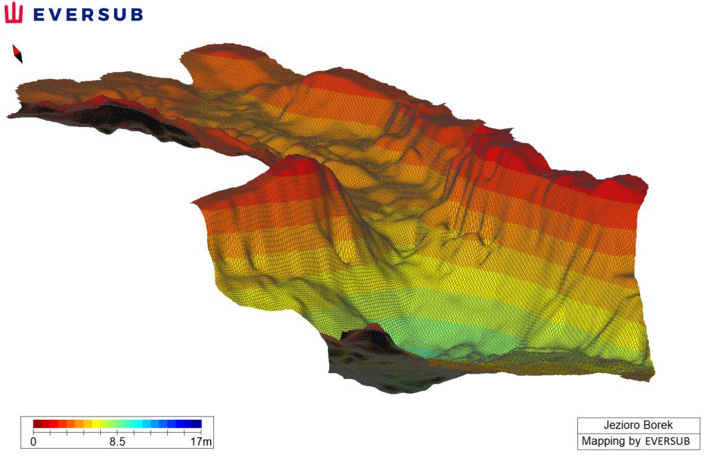
3D bathymetric chart of a fragment of Lake Borek in Lubuskie Province
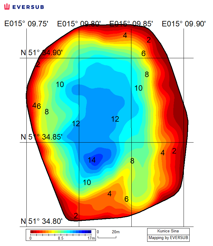
Bathymetric chart of Sina Reservoir in Kunice, Lubuskie Province
Checking the Bottom for Obstacles
We locate underwater obstacles that could pose underwater risks for vessels, hydrotechnical structures, underwater installations, and people.
Scope of activities in the field of bathymetric works and checking for underwater obstacles
- We make bathymetric charts for institutions and individuals
- We make 3D bathymetric charts of the bottom
- We determine the presence of underwater obstacles with their exact GPS position and depth
- We carry out the dimensioning of underwater obstacles
- We perform underwater verification of underwater obstacles
- We issue a bottom clearance certificate
- We issue a bathymetric works report
- We check bathing sites for the safety of users
- We check water bodies for navigational safety
- We make bathymetric charts and check the bottom for obstacles before the construction of hydrotechnical structures and any underwater installations
- We make bathymetric charts and check the bottom in the area of hydrotechnical structures and underwater installations to ensure operational safety
- We conduct underwater monitoring of dredging works
- We conduct underwater monitoring of the construction of artificial islands, quays, stone embankments, and of the laying of underwater mats
- We monitor the accumulation of bottom sediments and changes in the bottom topography
For bathymetric works and bottom surveys, Eversub uses the latest hydroacoustic technology: echo sounders, sonar and underwater ROV robots.